It's been nearly a year since I started this project, and by the end of the last episode I'd arrived at a considerable set of village terrain. All together, it fills the 4x4 mat to a pretty ludicrous degree, with about 60% of the total mat area covered with terrain and scatter, all at least loosely themed to the 10th-11th century in Egypt. I was all set to start moving through time, adding 12th-17th century features and moving on to the Napoleonic period and WW2. And then, a lot of kit arrived. An awful
lot of stuff, and
buildings, and a
market set, and on top of that -
an entire town.
With the village board almost too full of terrain pieces - and my storage box overflowing - I need a plan to integrate all this newly arrived stuff into the continuing story of Nakam Aya'If, and after playing a few games in the village - and most importantly, realising it makes a great setting for train play with my son, I want to expand the scope of the project to the surrounds.
Where Are We?
To do that, let's refresh where we are in the world. I've moved it around a little, but Nakam is in Matrough Governate, the border territory between the Nile delta and what is now Libya. It's been fought over - and those battles have been commemorated in the terrain set - for thousands of years. Nakam is a small village that is part of scattered pastoral farming around the crossroad that runs north/south between Marsa Matrouh and Siwa Oasis and east/west along the coast as part of one of the great north saharan trading routes. The village is sustained by relatively easy access to water, and sheltered from desertification by a deep valley.
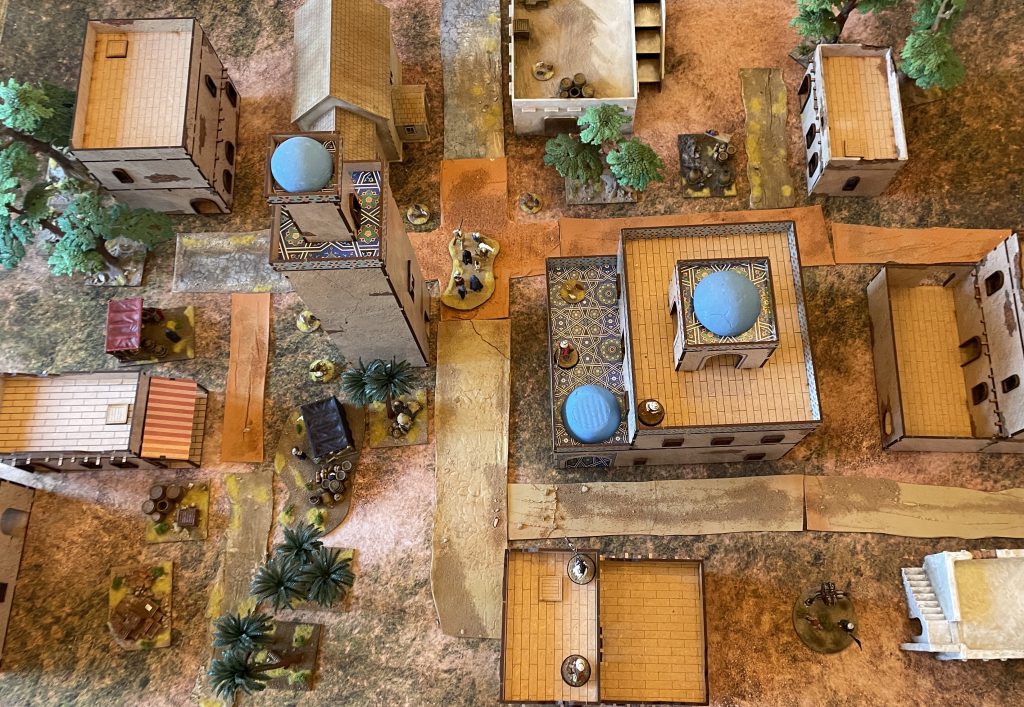
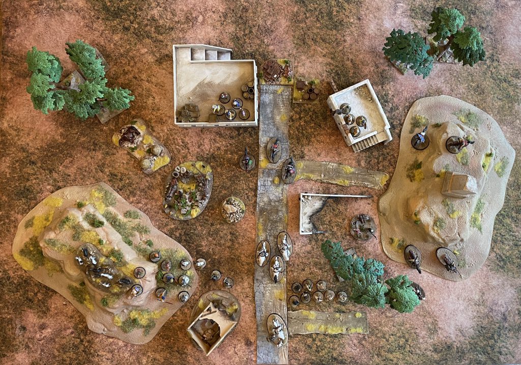 The Village of Nakam as it stands in 1096. Credit: Lenoon
Given that eagle eye's view, we can zoom out to see what would make sense in opening out the scope of the Egypt project. Nakam is off a small spur road from the main routes, so we'll chuck it somewhere off to the West among the wadis outside Marsa Matrouh. There's a lot of different environments here - Marsa Matrouh itself was a significant urban centre from the 8th century BC onwards, the wide open spaces of the western desert are just to the south, and the ruins of caravanserais, wells and villages litter the area.
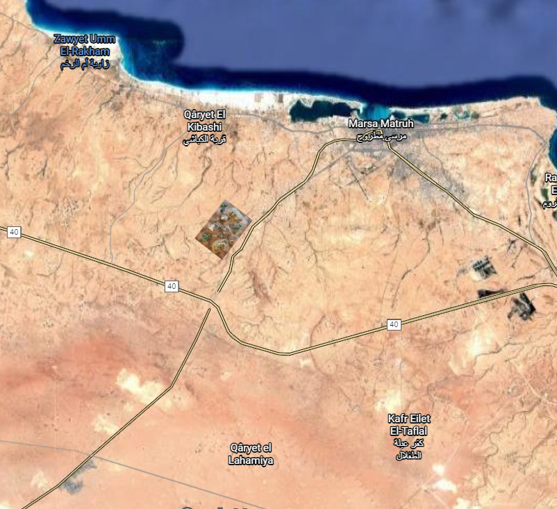 Nakam in Context - just to the west of what's now the Matruh-Siwa road
It's also a culturally varied area, with Byzantine and Egyptian Christian populations mixing with (and being supplanted by) Arabic settlers and cultures along the coast. The people of Nakam and the surrounds will be fairly well integrated into wider Egyptian society. To the south, Bedouin and Tuareg tribes are the inhabitants of the more desertified areas, either semi-permanently or through trade relationships. That all bodes pretty well for my project, as I can very quickly set up some new terrain sets and give them a strong theme! Instead of following one board over a thousand years, it's time to start thinking about four!
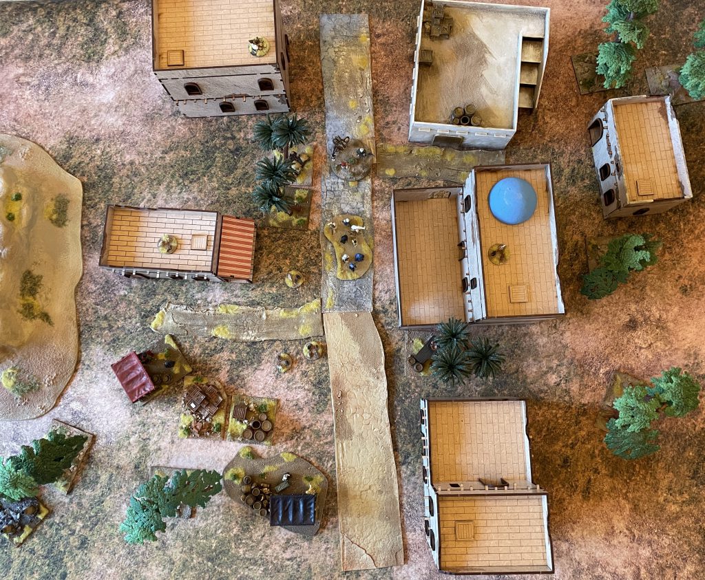
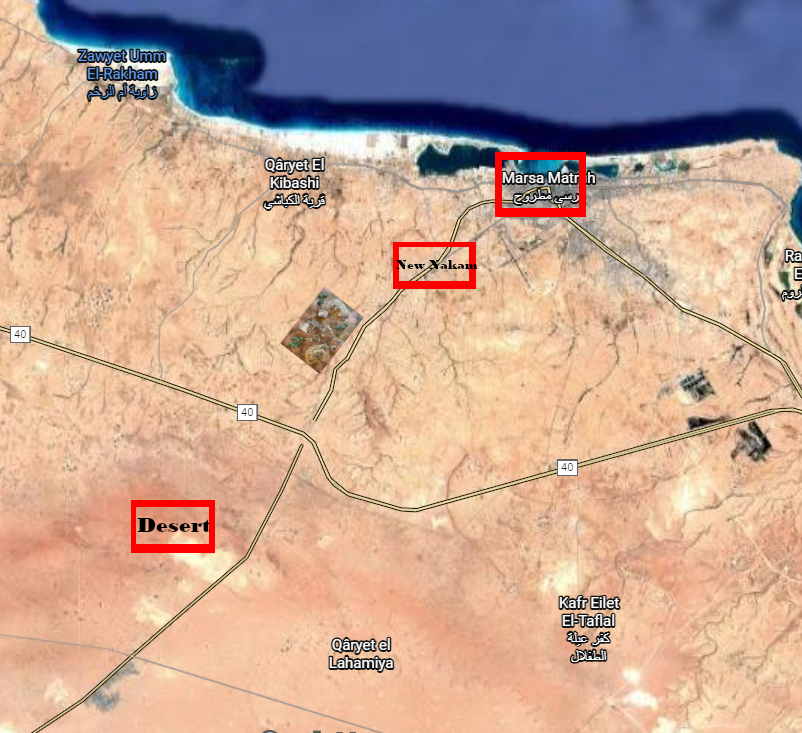 A rough map of the four boards I'd like to build
Nakam Aya I'f
The village is now done - there will be scatter terrain changes as we go through time, but overall the inhabitants will carry on farming and rebuilding mud-brick buildings throughout history. A Nakam Aya I'f board will have:
- Two Hills
- Small Well
- Variable (3-4) buildings
- Farming scatter
- Small road
All of that is put together, so we're all good to go.
 Nakam Aya I'f, with a more reasonable amount of terrain! Credit: Lenoon
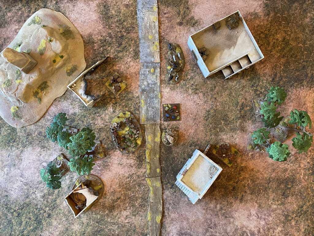
New Nakam
The first market town north of the Desert, New Nakam (name pending!) isn't a real-world place, but is based on the settlements along the Matrou-Siwa road. It's a settlement that might be expected to have more to it than Nakam, based around a Caravanserai with accompanying market. It's a good place for Desert/Coastal trade to take place, and the families of Nakam travel there to sell their produce. It's a little wetter than the village, downstream of the wadi network.
 Tree lined avenues! Credit: Lenoon
A town board will have:
- Roads and paths
- 4-5 buildings
- One larger building, representing the Caravanserai (until I build one!)
- Market scatter
- "People" scatter
- Larger well
- Camels!
The trading cycle this will represent is Bedouin-Arabic trade, where Bedouin groups bring hides, wool, livestock and long-distance trading items to market centres to exchange for farmed produce like dates and grain, and finished crafts that are more readily made in towns. The town exists entirely as a trading centre - if this trade dried up, there'd be no town until you hit the outskirts of Marsa Matrouh itself.
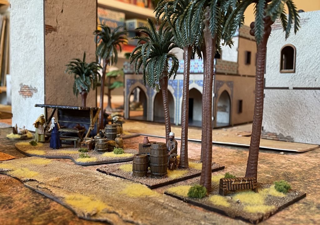
 Victrix Markets with additional trees and merchants Credit: Lenoon
The Victrix Market set has provided the majority of the market town terrain needed for this month's plans, with two market stalls and several smaller pieces of scatter representing places to buy and sell. To give them a little more Egyptian theming, I've used Islamic and Western Medieval civilians from Reconquer designs and very cheap plastic Temu palm trees. Mixed in with some of the Bandua Medina buildings, this board feels different to the rural village while using most of the same pieces.
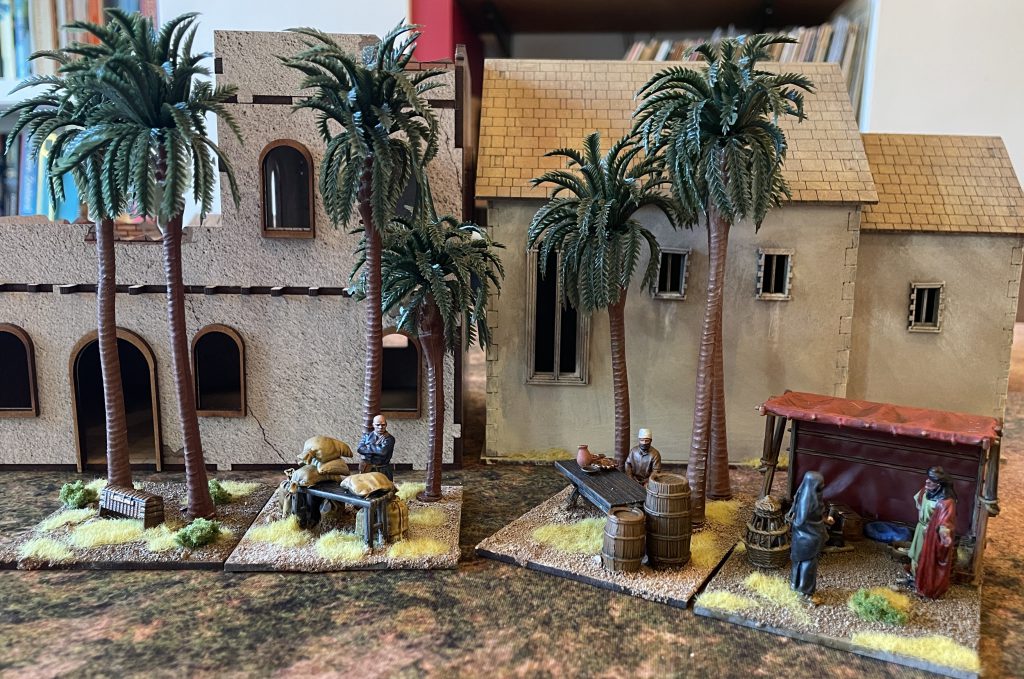
 New Nakam Credit: Lenoon
Marsa Matrouh
Marsa Matrouh itself is probably a longer term project. Building up a port city over time is going to be a big job! Having said that, the sheer volume of buildings I've ended up with can give me a pretty convincing fully urban board. While I haven't dug much into the history of Marsa Matrouh yet, I can say it was an Egyptian, Byzantine, Coptic and Arabic port town, so there's lots of scope for cosmopolitan architecture and chucking in a lot of different styles.
 I'll never get tired of posing these shots Credit: Lenoon
A Marsa Matrouh board will have:
- As many buildings as practical
- Roads and Paths
- Communal water sources - probably a Qanat system
- Large buildings - Mosques, Minarets and Churches
- Incidental urban scatter - bricks, barrels, wood, marketstalls etc
- People
With the buildings from the Bandua set and those already made for Nakam Aya I'f, I already have a pretty full urban board to represent the city, and some of the scatter I've made so far works already. There are some big projects here to organise - a Qanat will be a substantial effort, and dressing up the city so it doesn't look like a collection of MDF buildings will need a lot of details. The bulky work is done - just the hard details to go!
 Marsa Matrouh will be the longed-for full urban board! Credit: Lenoon
One of those details will be more paths and roads, which means I've picked up more caulk. This time I'm trying out coloured sealant in a light red-brown. I've read a lot about caulk roads curling and peeling, so have tried out a different way of backing the caulk lines while they dry to keep them level. Thin, shopping-bag plastic doesn't work well, but thick paper/card for watercolours does! The road network production line is well underway:
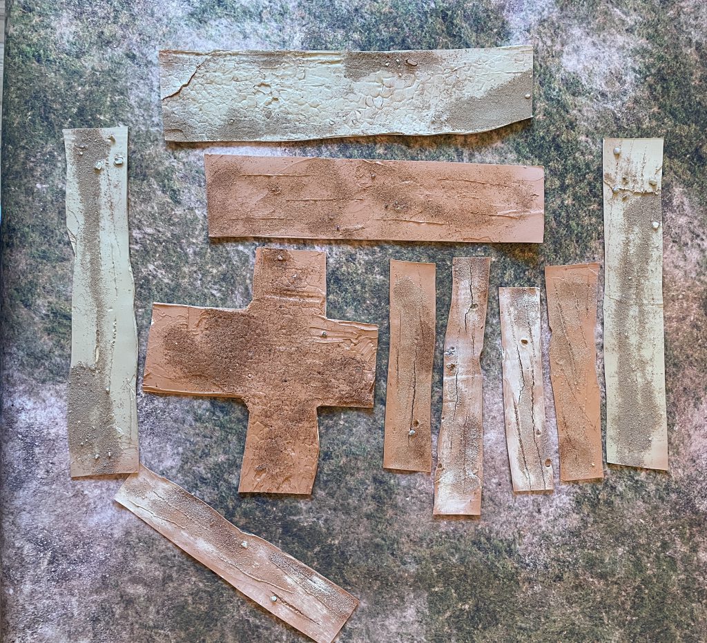 Caulk roads. Credit: Lenoon
The Desert
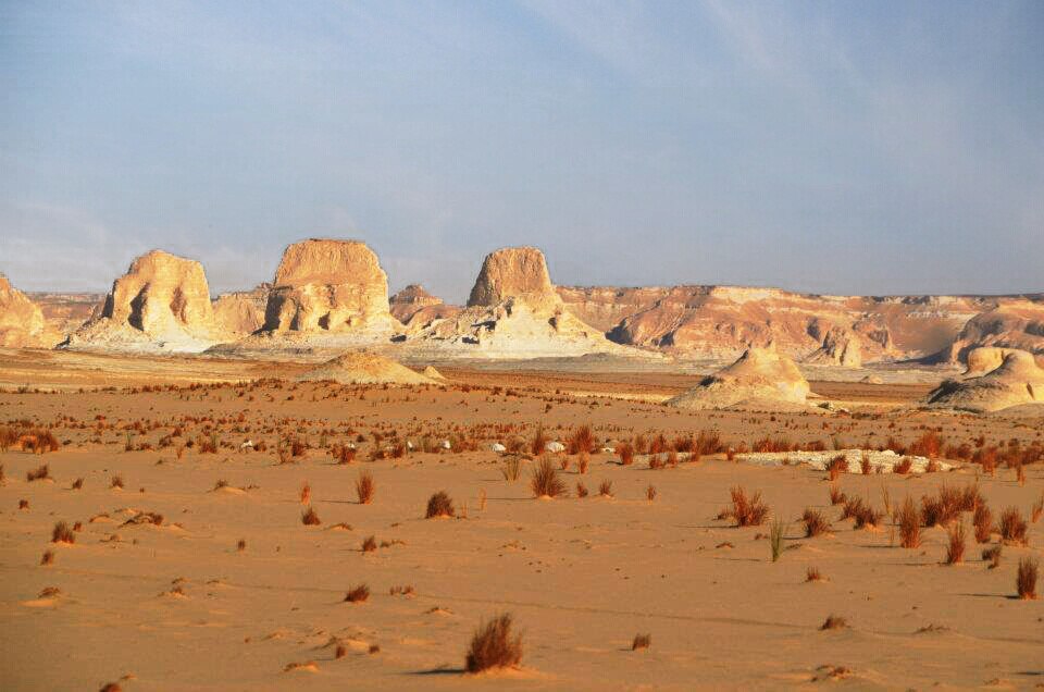 The Western Desert. Credit: Creative Commons Attribution-Share Alike 4.0 International license.
The deep desert in 1096 won't have all that much in it, but it's a board that I'm looking forward to building for WW2. As it is, a desert board will have:
- Hills
- Possibly a small fire/camp
- Rock outcrops
- That's it!
I probably need a different mat for this one - the Western Desert is much more arid than my mixed scrub board can represent! The desert is in many ways the first line of defence for the other boards - hold the line here and you don't need to fight in the village, town or city!
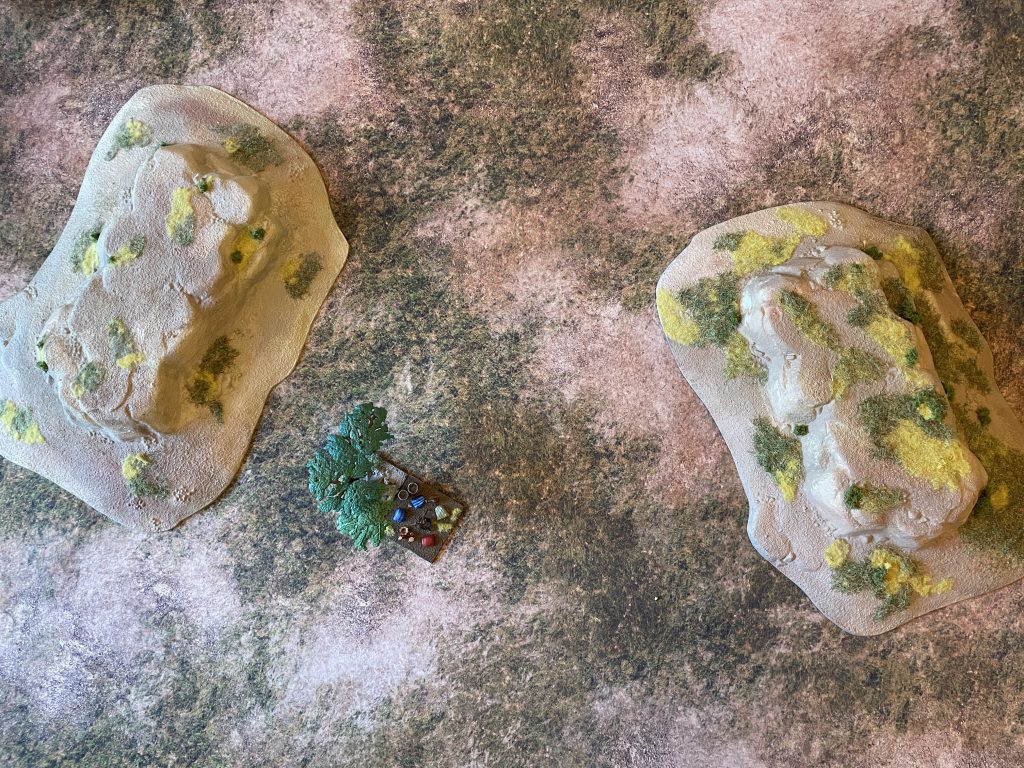 The Desert board. Credit: Lenoon
The Future
Everything is in place - with the exception of a few specific builds - for the whole area in 1096. That's important, because we left off last time with the arrival of the Crusaders. We're in Egypt, not Palestine, so this isn't a process of establishing solid crusader kingdoms. One of the things that incited this whole project was a throwaway line in Christopher Tyerman's "God's War: A New History of the Crusades" - the arrival of lost fleets of Crusaders off the coast of Egypt.
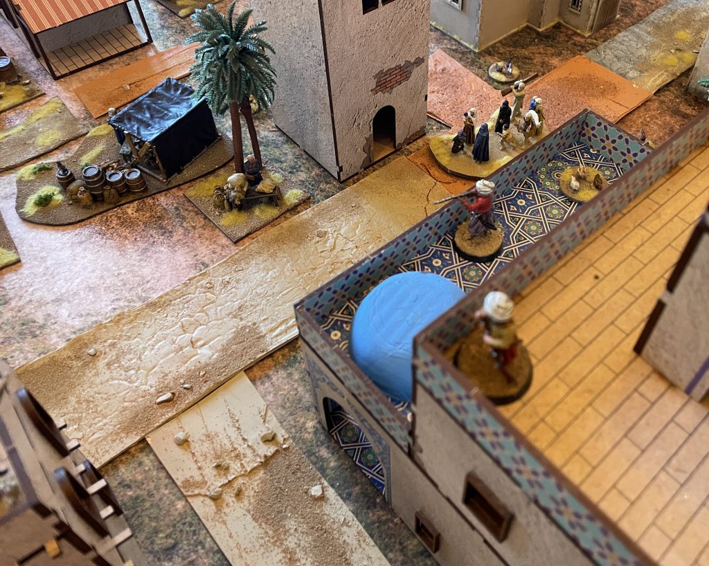
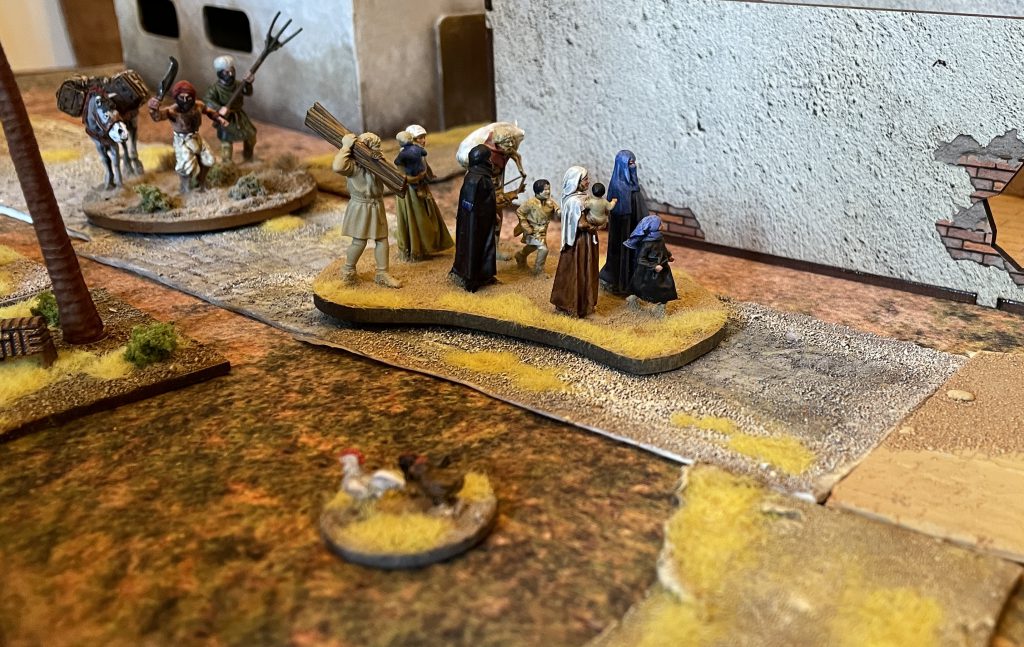 Inhabitants Credit: Lenoon
I dug into this a little - there's not much out there - to find that during the first crusade, scattered fleets of Crusaders who had no idea where they were or what they were supposed to be doing (beyond "get to Jerusalem") landed up and down the Egyptian coast. I've decided, not unreasonably given the sometimes very rapid acculturation of Crusaders into Levantine contexts, that some of them landed, and stayed in, Matrouh. They rebuilt Coptic churches along Norman patterns - letting me slip that Norman church into my City board - and continued to worship in their own ways while paying the jizya tax to local lords. That's going to give New Nakam and Marsa Matrouh a little bit of western Christian architecture, art and people - handy, that - setting us up for 1097 all the way through to the 14th century.
 I did try out a little bit of Napoleonic skirmish in the end Credit: Lenoon
I'd like to come back to the 14th-17th centuries when I have armies to play with them - so instead the next phase of this project will be skipping far, far forward into the 20th century, where for much of the period from June 1940 to November 1942, Matrouh was the front line between Axis and Allies. Next time we'll have a look at how to turn medieval villages, towns and cities into settings for the Desert war.
Have any questions or feedback? Drop us a note in the comments below or email us at contact@goonhammer.com. Want articles like this linked in your inbox every Monday morning? Sign up for our newsletter. And don’t forget that you can support us on Patreon for backer rewards like early video content, Administratum access, an ad-free experience on our website and more.Thank you for being a friend.


 Infinity N5 First Principles: Understanding the Outcomes of Face to Face Rolls
 Tactical Feedback: Timing the Go-Turn
 SRM's Roundabout to Adepticon 2026: Curd Is the Word